


Western Europe just had its hottest summer on record. According to the Copernicus Climate Change Service, June and July averaged 21.62°C, nearly 2.8°C above normal and higher than the previous record set in 2022, with repeated heatwaves pushing temperatures above 40°C across Spain, Portugal, and France. Against that backdrop, three shade-routing tools appeared over the summer: Cool Routes (June), Geuneullo (July), and Yandex Maps’ Green routes (August), preceded by HEAL's expansion to 80 German cities in May.
This timing isn’t only about extreme heat. Navigation is becoming contextual, taking into account more than just the shape of the street: heat, air quality, noise, physical strain. Green Paths, a beta planner from the University of Helsinki's Digital Geography Lab, has let residents choose quieter or less polluted walking and cycling routes for years. It is not shade routing, but it is the same idea arriving early.
How shade routing actually works
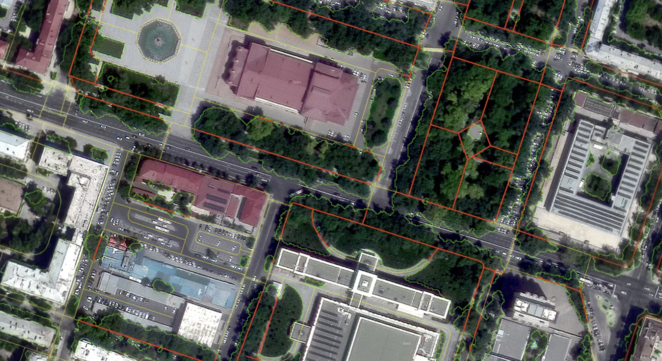
Modern shade-routing tools start by figuring out where the shadows fall. Three technical approaches have emerged.
- Geometric: calculates the position of the sun and combines it with 3D models of buildings, terrain, and trees to determine where shade falls. Geuneullo, Germany’s shaded.ors engine, and HEAL use versions of this approach.
- Biophysical: estimates the total heat load a pedestrian would feel, combining temperature, humidity, surfaces, and solar radiation into mean radiant temperature (MRT) — the basis of Cool Routes.
- Satellite-based: recognizes tree canopies from multispectral imagery, then calculates how much of a route passes beneath them, which is Yandex Maps' method for its Green routes feature.
Who's building it
Cool Routes (Arizona State University), unveiled in June 2026, factors in hourly weather, tree cover, building shadows, and MRT. It found cooler alternatives for more than 70% of test trips, cutting the heat load for walkers by about 2.5°C on average without significantly increasing distance. For now, it covers the ASU campus in Tempe and remains a research tool rather than a city-scale public product.
HEAL (Germany) uses geodata to calculate shade from buildings and vegetation alongside the pedestrian road network. Its development also drew on research involving older adults and other heat-vulnerable groups, with the aim of routing people through parks and other cooler areas rather than exposed streets. The algorithm was modeled on roughly 10,000 pedestrian trips and piloted in Heidelberg before extending to 80 major German cities.
The National Shade Map (UCLA and American Forests), launched in June 2025, covers more than 360 U.S. cities and shows shade from trees and buildings at noon, 3 p.m., and 6 p.m. Rather than offering turn-by-turn navigation, it is designed for uses such as evaluating school routes, bus stops, and parks.
Geuneullo 그늘로, roughly "to the shade" (South Korea), launched in July 2026, calculates the sun’s position and the shadows cast by buildings and trees at a chosen time and offers users not just the shortest walking route but the most shaded one. The app also shows what share of a route runs through shade, and advises which side of a bus or subway car to sit on to avoid direct sun. By August 5, 2026, it had reached number one among free navigation apps in Korea's App Store, ahead of Google Maps, Kakao Map and Naver Map.
Google Maps, the world’s most widely used mapping app, has yet to release a feature like that. In November 2025, Android Authority uncovered a "Prefer shade" setting in an APK teardown of the app. The feature appeared designed to let users favor shadier streets, distinguish between sunlit and shaded sections, and show estimated time spent in direct sunlight. However, the setting was not functional at the time, and Google has not officially announced or confirmed a public launch since.
Yandex Maps Green Routes, launched in Tashkent, Uzbekistan, in August 2026, is the first deployment of this kind of feature in Central Asia. Yandex Maps operates in 30 countries, and Tashkent is the first city to get a full rollout — powered by an ML algorithm trained on satellite imagery. The tool counts a stretch of sidewalk as shaded only once tree cover reaches 60% of its length, and total shade is not the only factor. The algorithm also checks how evenly the shade is distributed along the route and how long the sunny gaps run.
Where this is going
Shade is becoming a measurable feature of the urban environment, on par with transit access or air quality, and every part of the chain is doing something different. Cities are mapping their tree canopies and planning new planting around them. Researchers are refining exactly how to calculate heat load. Map and navigation services are turning that knowledge into a specific route for a specific person.
None of it adds up to a standard yet, but the overall direction is consistent. The map is starting to account for the person walking, not just the road they are walking on.


