

I have a friend who suffers from the illusion of short distances. So, whenever he wants to take us for a walk, he assures us that it's a short distance. But every time we've taken his word, it's over 5km. But since I discovered I could measure distance on Google Maps, I've no longer been a victim of his distance illusion.
The thing is, Google Maps allows you to measure the distance between points. Unlike the standard directions feature, which calculates travel distance along roads, this tool measures straight-line distance, or lets you plot custom paths with multiple stops.
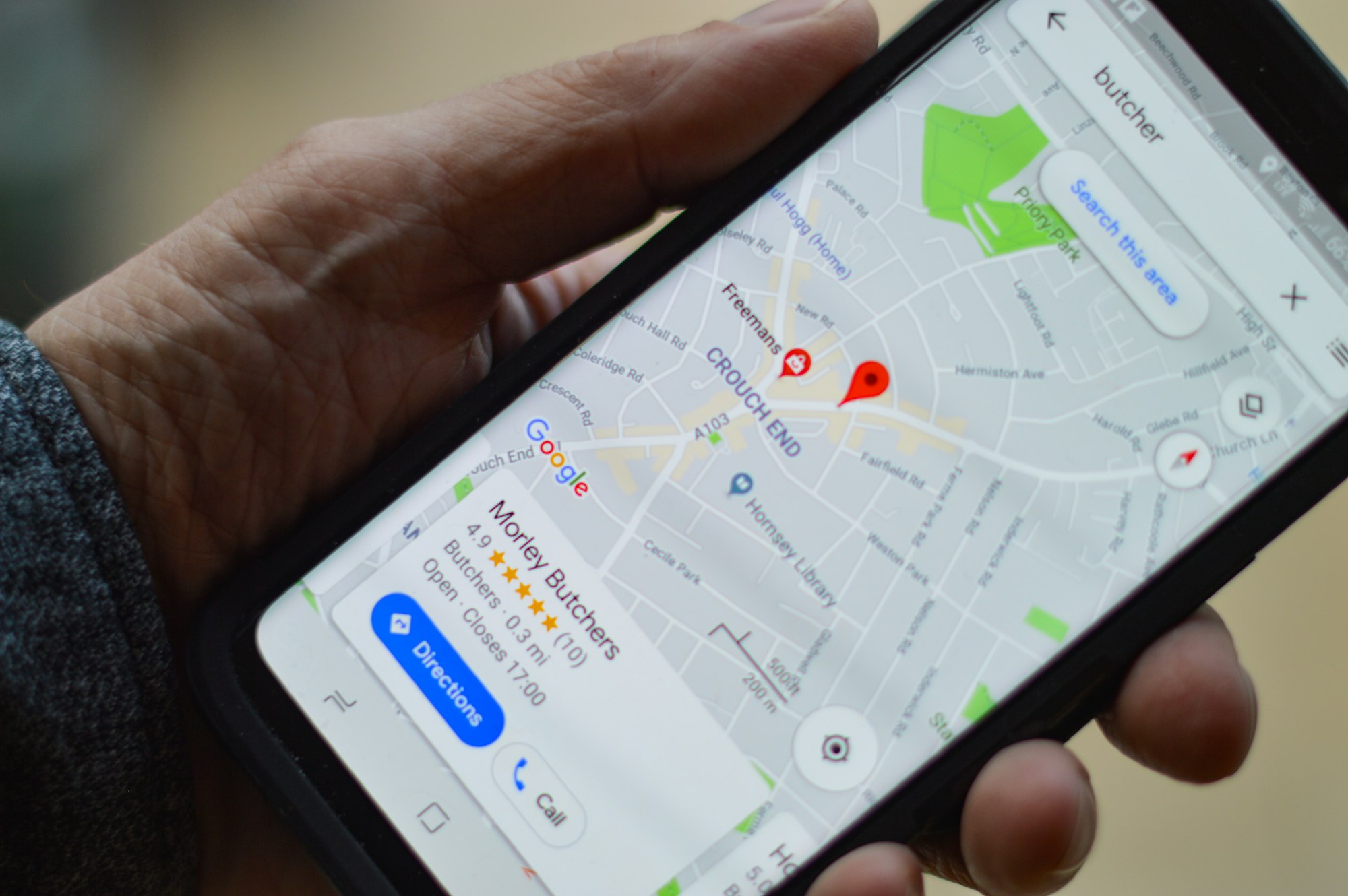
If you want to know the distance for your morning jogs, or to walk your dog, whatever, really, you can use Google Maps to find out how far or near a place is. In this guide, we’ll show you how to measure distances on Google Maps.
How to Measure Distance on Google Maps
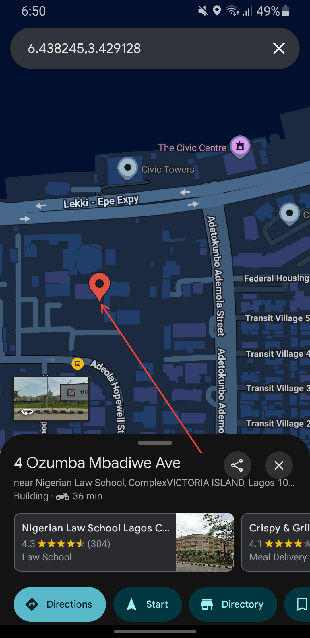
Step 1: Open Google Maps and long-press your starting location until a red pin appears.
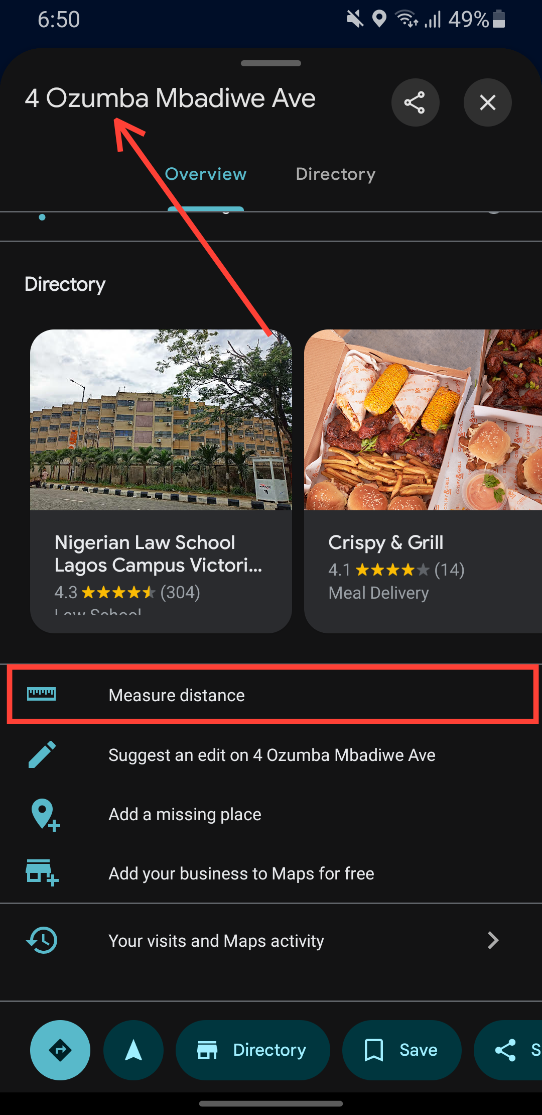
Step 2: Tap the place name at the bottom, then select "Measure distance".
Step 3: You'll be returned to the map, and a white crosshair will appear, replacing the pin.
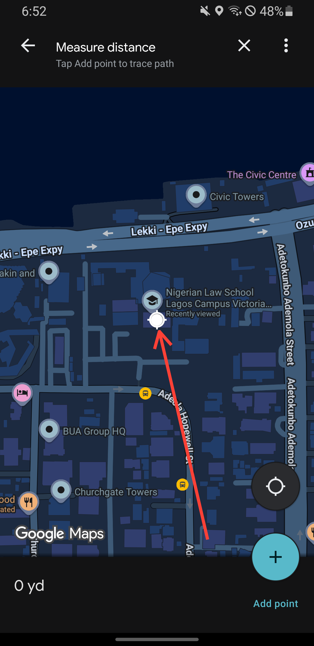
Step 4: Drag the map to move the crosshair to your next spot.
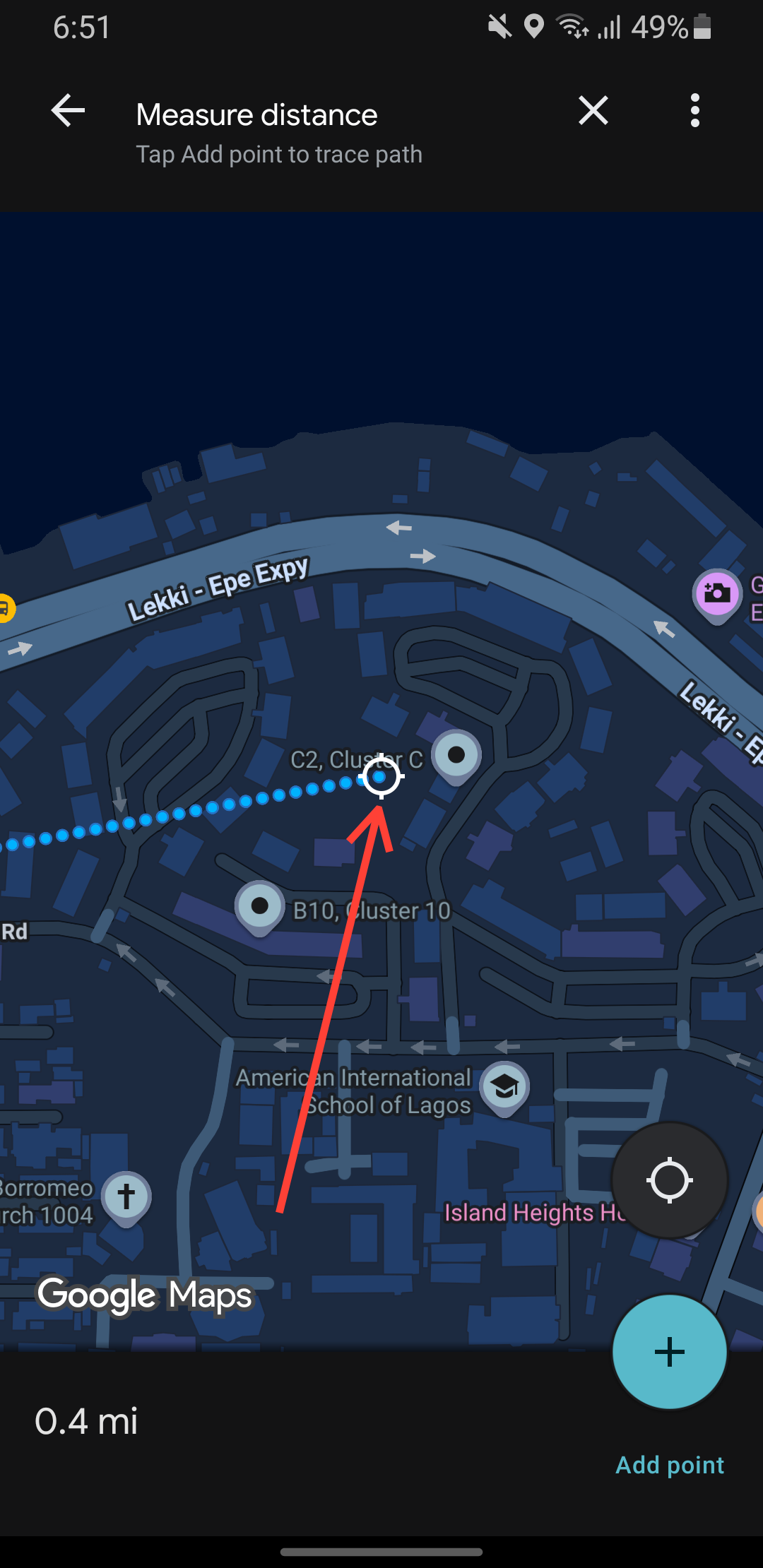
Step 5: To measure a more complex route, keep adding points with the "+" button at every turn.
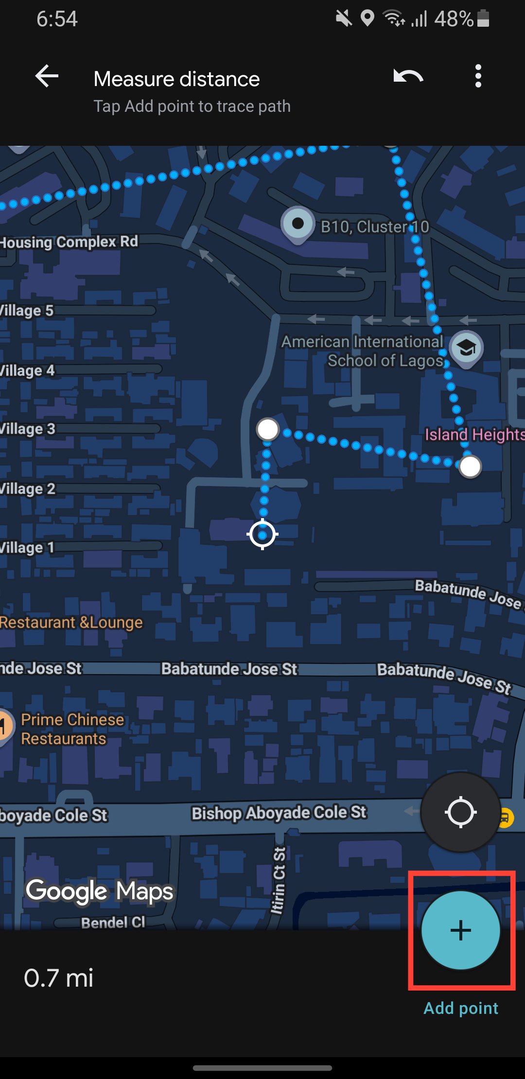
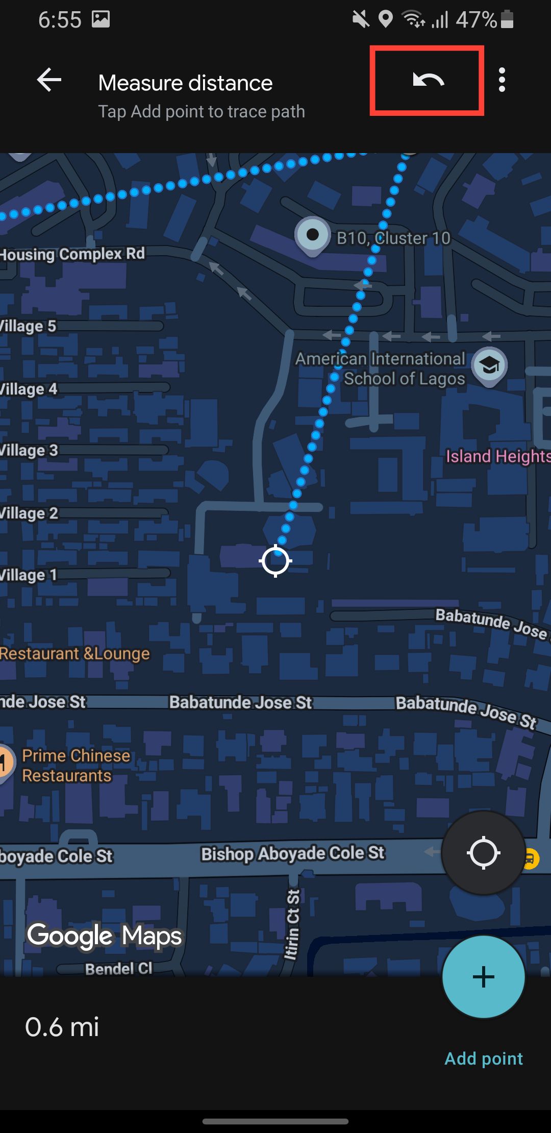
Step 6: If you make a mistake, tap the undo arrow to remove the last point.
Conclusion
With Google Maps distance calculation, you never have to guess the distance of the route you want to take or rely on inaccurate information provided. It's like having a digital tape measure for the entire world in your pocket.
This is one of those small tech features that quietly makes life a little easier, and once you start using it, you'll wonder how you ever got by without knowing exactly how far things are.
Image Credit: Oyinebiladou Omemu/techloy.com


